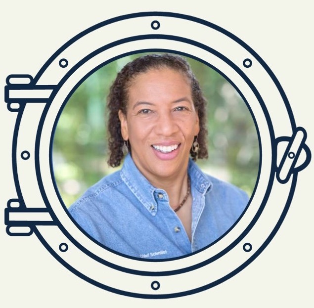
Charting a New Course: Dawn Wright
This profile is part of our series celebrating contemporary Black geoscientists in honor of Black History Month. Learn more here.
Dr. Wright, aka “Deepsea Dawn,” is a marine geologist and geographer. She currently works as the chief scientist at the Environmental Systems Research Institute ("Esri"). Esri is the company responsible for building ArcGIS (GIS = Geographic Information Systems), a powerful mapping and spatial analytics software which has applications from environmental research to city management. Wright also holds a courtesy professorship at Oregon State University, where she has been on the faculty since 1995. Wright is recognized as one of the key developers of GIS technology, from its infancy up to today.
Wright grew up in Hawaii, with an early interest in the oceans and mapping. In an article for Medium, she describes how childhood reading about pirates and treasure maps inspired her: “I fancied myself a pirate … I wanted to know how to make maps myself. What’s beneath the surface of the ocean, and how in the world do you map it?”. She carried that fascination into her career. After completing her undergraduate degree at Wheaton College, she went on to complete a Master’s degree in Oceanography at Texas A&M. She then spent most of three years at sea as a marine technician for the Ocean Drilling Program, which conducts research on the history of the oceans and the Earth’s crust below the seafloor. In 1994, she completed her PhD in physical geography and marine geology UC Santa Barbara. Until 2013, she worked primarily as a professor at Oregon State, with both teaching and research responsibilities. She has since taken on the role of chief scientist at Esri, while maintaining a courtesy professorship.
Wright’s research has focused on improving GIS mapping technology and applying GIS to better understand the seafloor. She has published on seafloor spreading zones, coral reefs, and improvements and challenges in marine mapping. When asked to explain what she works on, she told the Atlantic “I make maps of the ocean floor to unlock the buried treasure of scientific insight, so that we can understand how that part of the Earth works, and hopefully how we can better protect it.” You can learn more about Wright’s work on her website here.
We asked Wright what she would say to an undergraduate STEM student to encourage them to use their training to study research questions in the geosciences. Her answer was thorough and emphatic:
“Given the year that we’ve just been through, as well as being a fan of Comic-Con, I can’t help thinking about superheroes all the time, and how studying research questions can actually turn you into a superhero for the planet. The clear, present, AND future dangers of climate change alone are enough that we need people of all backgrounds and perspectives to enter the geosciences to research these questions and to find practical, science-based solutions as well. This is what we sometimes call 'use-inspired' science, because depending on the questions, it boosts the likelihood of your science being successfully incorporated into environmental decision making and policy. And for so many young people that is super cool and super NEEDED, especially if you foresee a career not only in academia, but in an environmental non-profit, in an environmental government agency, or in a conservation-based, environmentally passionate private company such as the company that I work for (Esri).
And in terms of the ocean, we now know beyond the shadow of a doubt that the ocean is central to our health, prosperity, and well-being, and we can think of the ocean as powerful source of solutions to climate change and other degradations."
Wright offered the following examples of research areas in oceanography that need the attention of a new generation of oceanographers:
"Ocean-based renewable energy siting such as wind, wave, and tidal energy infrastructure ... energy efficient shipping ... fisheries, aquaculture, and food security ... and seafloor mapping including for better submarine cable routing – you have the internet because of the ocean! Wouldn’t you like to work in any of these fields? We need you!!!"
Read more of Through the Porthole Issue #1
Learn more about Through the Porthole
Learn more about the MIT-WHOI Joint Program