Woods Hole Oceanographic Institution

Going Home

As we find ourselves coming towards the end of this cruise it is a time to reflect upon what we have undertaken and offer our thanks to those who have made this possible, so here goes. To the crew of the Roger Revelle a massive thanks, as quite literally we could not have got here without you. You have done everything to make this as successful as possible for us, the food has been great from start to finish, and you have been a pleasure to sail with. So I think I speak for everyone in the science party in again saying a huge thanks and wishing you all the luck in the future!

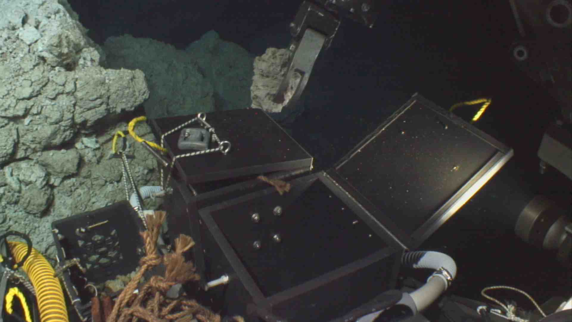
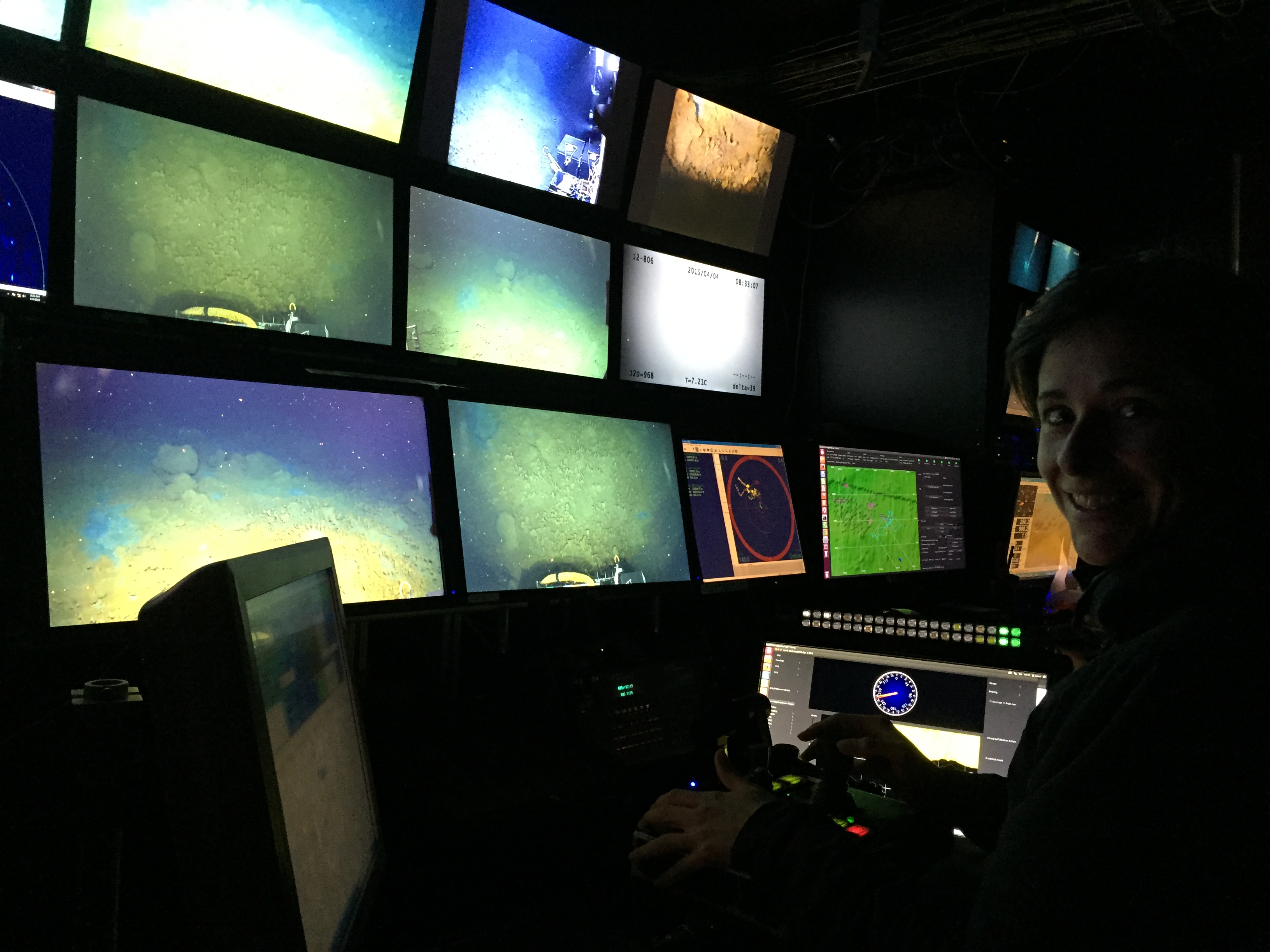
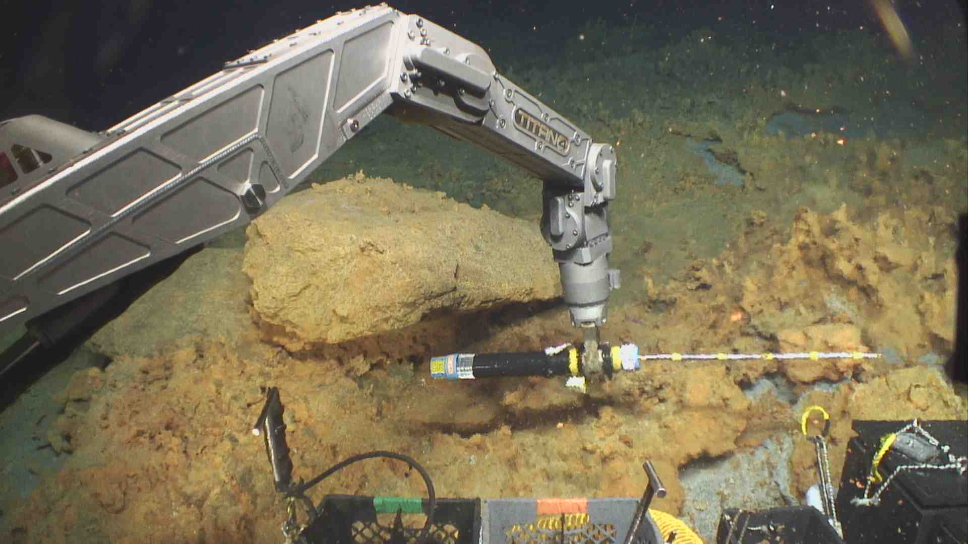
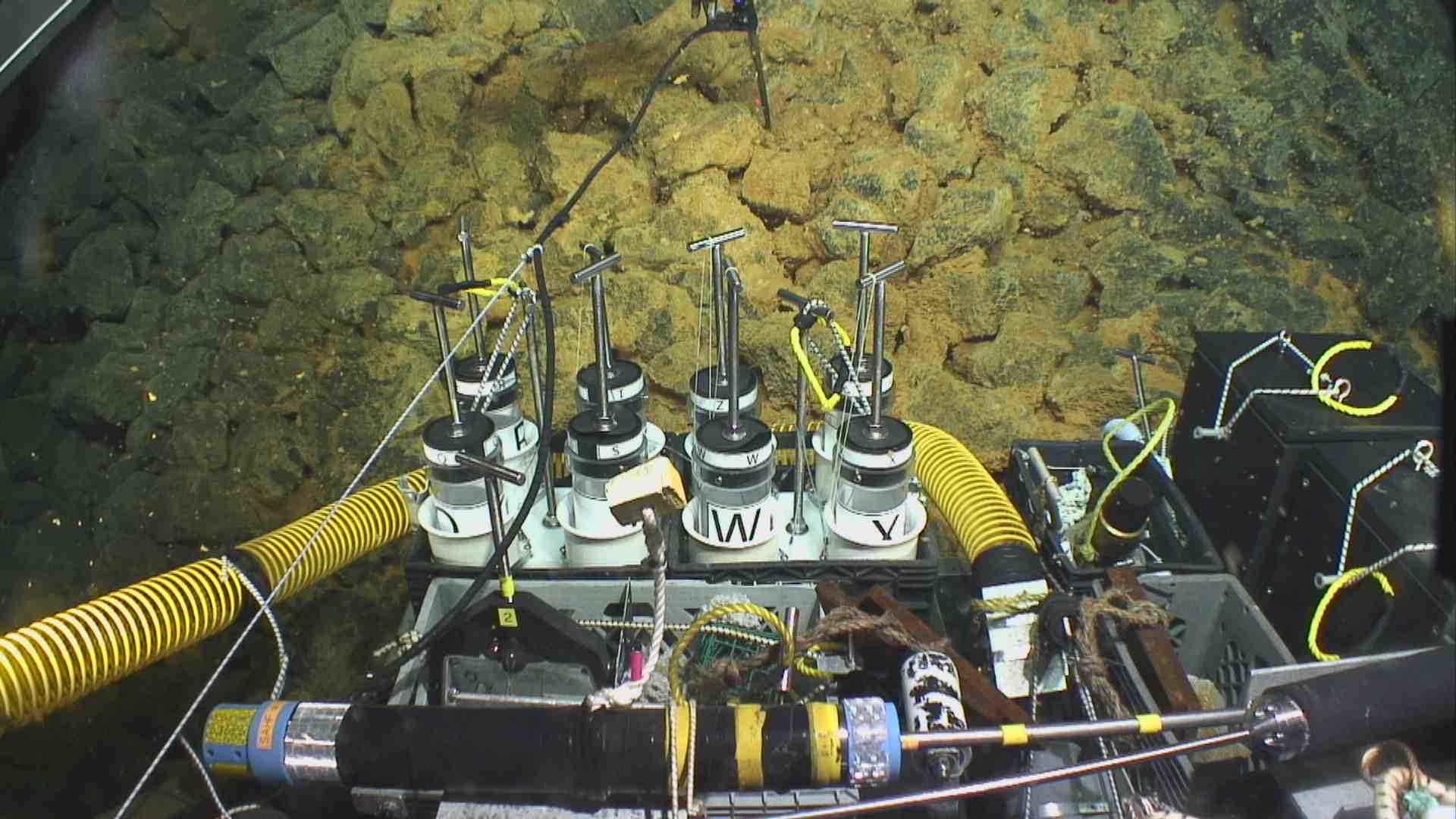
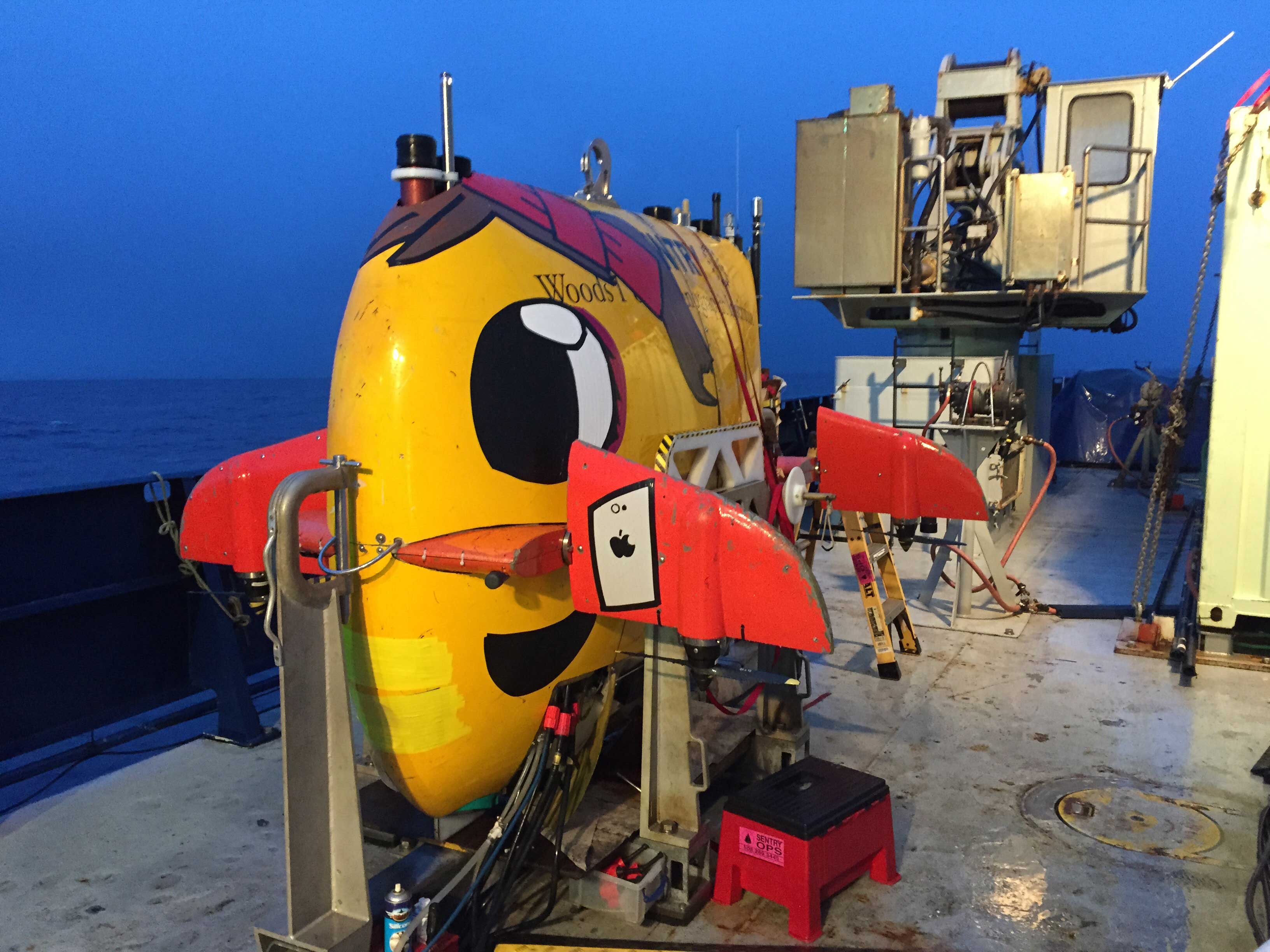
To the Woods Hole Oceanographic Institution (WHOI) group who have tirelessly operated the submarine vehicles Jason and Sentry, a huge thanks. Your efforts in operating 24 hours a day and consistently problem-solving to get to the places we wanted to observe and sample rocks made this cruise a huge success. Thank-you to the Chief Scientists for organizing this venture and then adapting as results came in. Because of your hard work we have been able to record a vast amount of information (~9 terabytes of raw data) about this eruption, giving us the best possible opportunity to learn the most we can and to use this knowledge going forward. I would also like to extend a thanks to everyone on the Roger Revelle for having been just been excellent in general. It has been a pleasure to spend the last few weeks at sea working with you all, so I wish you all the luck in the future and I look forward to working with you again.

As a first year graduate student, this is the first time that I have been truly exposed to the working world of science, and it has been fascinating talking with people that have lived and been educated all over the world. Traditionally the scientist is seen as a lonely eccentric figure who would spend years on his or her own in a lab working on complex problems. I now know that science is better represented by a diverse set of people working together and using each other’s strengths to achieve a much deeper understanding of our universe together than one could achieve alone. I have only just started my scientific career, but the prospect of continuing along this same path makes me very excited about the future. I can confidently say that I have immensely enjoyed my experience here and I will remember it for a very long time.

So I sit here, a few hours out of port, reflecting on the work that has been done here and the things I (and we all) have experienced out here. But we must also consider what is yet to be done. Not all endings are bitter and this is my no means an end—the research that has been started here will be continued for many years, by people here and elsewhere. I feel as though this quote from Winston Churchill sums up our current position: “Now this is not the end. It is not even the beginning of the end. But it is, perhaps, the end of the beginning.”

The 2012 pumice raft

The MESH expedition is coming to an end, and everybody is busy packing gear, writing reports, and trying to finish all the chocolate that is not allowed off the ship due to New Zealand biosecurity. We have had some choppy sea conditions these last few days, and a few of us (including myself) became a little paler, less hungry, and less talkative than usual. Thinking about the end of this adventure, I would like to share how it all started, and for this, we need to talk about one of the most bizarre things that can occur on this planet: mats of floating rocks, or pumice rafts, which are dispersed by ocean currents.

This wonderful adventure started in 2012, when Rebecca Carey and I were chatting online about the sightings of a giant pumice raft in the Kermadec arc, North of New Zealand. Some of our colleagues had tracked the source of the pumice raft to a barely-known underwater volcano, the Havre caldera volcano. At that time, medium-resolution satellite images were showing an immense volume of pumice in a pumice raft that was being widely dispersed in the Southwest Pacific Ocean. While Rebecca was frantically writing a proposal to fund this expedition in collaboration with Adam Soule, I focused on tracking the pumice raft to better understand how these giant bodies were dispersing, and where this raft would actually end up. Browsing on the internet, I found several blogs where sailing crews had encountered the pumice raft between the Tonga and New Zealand. I could collect data on dates and location of pumice raft sightings, and some crews even sent me their precious souvenirs of fresh floated pumice clasts (pieces) that they collected during their trip. This research brought about our first research paper on the Havre caldera, and it will be followed by dozens more as a result of the MESH cruise!

Ribbons of pumice clasts by a sailing crew in October 2012, in between Tonga and New Zealand. Photo courtesy: Ilkka Liukkonen

Ribbons of pumice clasts by a sailing crew in October 2012, in between Tonga and New Zealand. Photo courtesy: Ilkka Liukkonen

When we arrived by ship to our destination, the reality of the size of this pumice raft became clear: We realised that the one-day-old raft would have spread as far as we could see to the horizon. It is hard to imagine a sea covered by clinging and rolling white cobbles of pumice. Apart from pixelated satellite images, there are no photos of the raft taken at that time, because this volcano is in a very remote area, out of the main shipping routes. However, the remoteness of this underwater volcano is very fortunate, considering the damage such raft could have done to coastal areas by blocking many vessels and harbours for days to months. In October, three months after the eruption, several sailing crews encountered very dilute rafts, ribbons of pumice clasts floating together on the ocean’s surface. But these rafts were very dispersed compared to the original raft.

To put this in perspective, the 400-km2 (154 square-mile) raft at day one has dispersed to more than twice the size of New Zealand in three months, covering vast expanses of water.

During this cruise, we collected some of these pumice rafts that did not make it very far, being quickly waterlogged, whereas their siblings continued their long route in the Southwest Pacific, entrained by water currents. Stranding of pumice flocks have been documented in the Tonga islands, on the northern shores of New Zealand, and finally on the eastern coast of Australia, including Tasmania. And there is no doubt that some of these pumice clasts are still floating today…

Student art visits the seafloor

Before the cruise, several science team members visited K-12 classrooms to talk about ocean science and what our jobs are like as scientists. We brought styrofoam cups to the classrooms and the students inscribed and bedecked cups with art and messages. Their cups are here with us on the MESH cruise and we used Jason and the elevator to send each cup to the seafloor.

Over 125 K-12 students decorated cups. We’ve been impressed with the creativity and diversity of student art. Some of our favorite styrofoam cup quotes are: 

Windows is better than mac

Dear volcano, please don’t blow my cup to pieces, it would make me very sad

I am going to the bottom of the ocean

You never know what’s out there until you go 

Decorating styrofoam cups is also a very popular activity with the science team during break time. Tables full of research papers, maps, delicate deep-water hardware, and coffee brewing equipment have to share space with Sharpie markers and styrofoam.

Why do we decorate? Because sending colored cups to the bottom of the ocean with Jason is incredibly fun! Styrofoam has a lot of void space, gaps that make it very light relative to its size. When you subject the cups to the high pressures in the ocean, those little pockets of air are squeezed by pressure and shrink like popped balloons. The cups don’t bounce back – they deform irreversibly. So when they come back up, you’ve got a tiny cup.

After the trip, the miniature cups will be returned to their student creators. It’s fun to let students create their own artwork and shrink it to learn about how pressure changes with depth. The cups also serve as a reminder that in a couple years, the students can be with us here too, investigating the unknown places and processes on Earth.

By Warren McKenzie and Kristen Fauria

Sentry Deployment


The Sentry team deploys AUV Sentry for a dive. (Video courtesy Dan Fornari and S. Adam Soule, WHOI, and Rebecca Carey, Univ. of Tasmania/NSF/WHOI-MISO Facility ©2015 Woods Hole Oceanographic Institution)

Driving the ROV Jason

During ROV Jason operations on the seafloor there can often be ‘spare time’ when we’re waiting for a measurement to complete or when we’re traversing between locations for geological observations. Recently there was one such time when we were waiting for a measurement of heat flow to be finished. So I jumped in the driving seat of the ROV Jason!

With the offer to give Jason a quick spin on the seafloor I promptly replied, “I was very good at computer games as a child so I’m sure I’m not going to destroy the Jason!” Was this welcome news for the Jason operations team? I’m not so sure…

Piloting Jason was partly like playing a computer game and partly like using a flight simulator. But driving Jason is especially dynamic and challenging because the driver has to coordinate with two other engineers to move the ship and monitor Jason’s tether to its partner vehicle Medea and the boat.

Jason weighs about 5000 kilograms, yet is able to hover and move in all directions on the seafloor just like a helicopter in the air. I was tasked with the job of traversing laterally (i.e., moving to the side while facing a hill) while looking at the rocks. The outcome of my driving time was that I didn’t bump into anything, but I was about 45 degrees off the planned direction!

Jason can not only move around in any direction, but can also sit on the seafloor or hover in mid-water and use its manipulators to pick up rocks and our measuring equipment. The manipulators work like a human arm, with joints that permit separate movement of the upper or lower arm. Jason has a shoulder, elbow and wrist joint, but unlike the human arm Jason’s hand can spin continuously. This is of real benefit when we need to drill into volcanic deposits with our corers. The joystick for the manipulator arms is a miniature replicate of the real manipulators – so its relatively quick to adapt to. Using the manipulators was really fun – the idea that I was moving the Jason’s arms at more than 1000 meters (about half a mile) below sea level was aweing.

One significant benefit of driving Jason was realizing just how skilled the ROV pilots are. It has helped me to plan missions and sampling tasks while on the seafloor to make operations easier for the ROV pilots.

Thank you Jason team!

Hydrothermal vents

Hydrothermal vents are places where hot water or steam comes out at the Earth’s surface. On land, hydrothermal vents are important for recreation and for power generation. They also tell us about what is happening beneath Earth’s surface and indicate the presence of excess heat.

If you could take an elevator ride into the Earth, you would find that temperature increases about 25 degrees Celsius per kilometer (100 degrees Fahrenheit per mile). This change in temperature, or geothermal gradient, is normal and is primarily a result of the Earth’s continuous generation of heat from radioactive decay and the way heat diffuses slowly through the Earth’s brittle crust.

A hydrothermal vent, whether on land or under the ocean, means that something out of the ordinary is bringing heat close to the Earth’s surface. Often the cause is a cooling magma that has been injected into the Earth’s crust. While the magma may stay and solidify underground, heat from the magma can reach the Earth’s surface. Hot rock or magma warms nearby ground water, making the groundwater buoyant so that it flows up through cracks and little spaces within the rocks. When the hot water or steam reaches the surface, boom – a hydrothermal vent forms.

At Havre we’ve found several hydrothermal vents. We identify them by measuring temperature with a heat probe and observing temperature gradients that exceed the geothermal gradient. The presence of vents shows that there is still excess heat underground – possibly from cooling magma that was not erupted in 2012.

The seafloor here is not lifeless. Bacterial mats flourish around the vents we see at Havre. It might be surprising that life thrives in such deep, dark places, but hydrothermal vents bring dissolved minerals to the ocean bottom – the minerals are food for these deep water ecosystems! Life may have begun at the bottom of the ocean near a hydrothermal vent – a place where the interior and exterior of our planet are directly linked.

Chimlets2

Vent2

Sentry

My pre-existing excitement about participating in Mapping, Exploration, and Sampling at Havre (MESH) grew exponentially when I discovered that Sentry would be involved in our expedition. Sentry, featured in our ‘technology’ page, is an autonomous underwater vehicle (AUV) capable of surveying the seafloor at depths down to 6000 m.

Sentry (decorated by Justin) during the MESH cruise.

Sentry (decorated by Justin) during the MESH cruise.

Read More →

A ‘Day’ in the life of a Nocturnal Sea Scientist

Even now, over halfway through the expedition, some of us are still trying to come to grips with the abnormality of our shift times and sleeping schedules. Myself, I’ve found that breakfast becomes a midnight snack, exercise IS possible at 4am and that ping-pong makes for a good science break!

This being my first cruise, adjusting to this pattern is taking some getting used to, but it’s an incredible experience all the same. So as part of the ‘midnight crew’, I thought I’d give a rundown of how a day usually pans out for me at sea:

WARNING: May contain science and copious amounts of food. Read More →

Dance of the Underwater Robots

Research ships like Revelle map seafloor volcanoes with sophisticated sonar-type equipment and can produce topography maps of the seafloor. In 2002 Havre volcano was mapped by the National Institute of Water and Atmospheric Research (NIWA) vessel, Tangaroa.

After the 2012 eruption the ship remapped the volcano, and by comparing these two maps we were able to determine the new (in 2012) eruption products. I’ve been staring at these maps for the past two years and now I get to use the AUV Sentry and ROV Jason to do some underwater geology. Read More →

Jason Approaches

ROV Jason approaches a deep-sea elevator equipped with a timelapse camera across the seafloor of the Havre caldera. (Video courtesy Dan Fornari and S. Adam Soule, WHOI, and Rebecca Carey, Univ. of Tasmania/NSF/WHOI-MISO Facility ©2015 Woods Hole Oceanographic Institution)