CTD Survey
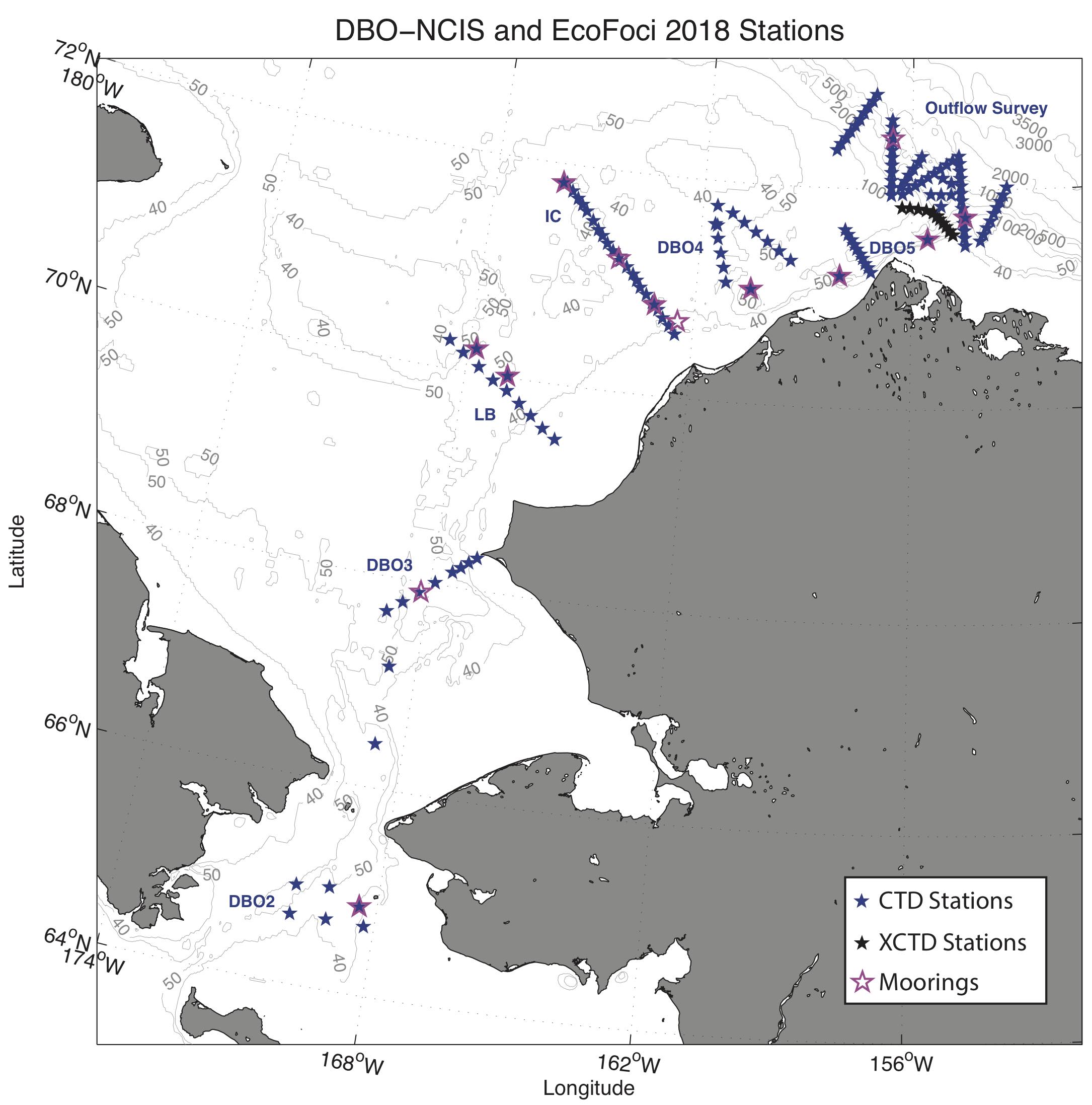
HLY1801 station map
A total of 142 CTD casts were occupied on the HLY1801 cruise, comprising 7 transects plus a Barrow Canyon outflow survey. The instrument package consisted of a Sea-Bird 911plus CTD measuring temperature and conductivity (dual sensors), pressure, oxygen, beam transmission, and fluorescence. This was mounted on a 24-position rosette with 10 liter Niskin bottles. An altimeter was used to bring the package approximately 2 m above the sea floor on the shelf stations (5 m in rough weather), and approximately 10 m above the sea floor on the stations seaward of the shelfbreak. Water samples were taken every 10 m on the shelf, including at the bottom of the cast, just below the surface, and at the subsurface fluorescence maximum (when it was present). For the outflow survey, the CTD casts were limited to 300m except CTD station 71 (see CTD table linked below below, or cruise report).
The overall CTD data quality was generally excellent. Downcast 1-db pressure-averaged files were produced following each cast. At the conclusion of the cruise a small number of density inversions were interpolated over, and salinity data quality was assessed. In contrast to the 2017 DBO-NCIS cruise, there were only two CTD casts that exceeded 300 m. As such, CTD primary and secondary 1 db conductivity values were regressed against each other in order to assess sensor performance. For more information on CTD sensor performance, please see the CTD calibration report (HLY1801_CTD_Calibration_Report.pdf). The final quality-controlled, calibrated CTD files are available for download below.
Using the downcast files, we constructed vertical sections of potential temperature, salinity, and potential density for each transect. The plots include the soundspeed-corrected bottom topography from the ship’s Knudsen recorder (smoothed to remove noise). We also constructed sections of the primary water masses present at each transect. All plots are available below.
HLY1801 water property section plots


HLY1801 watermass section plots


