Multibeam sonar scan of the East Pacific Rise
We’re still steaming toward our study site, but thanks to Atlantis‘ sophisticated instrumentation, we’re getting some science done along the way. Instead of making a beeline for the vents where we’ll spend most of the expedition, we’re transiting south along the East Pacific Rise, a boundary where two tectonic plates are sliding away from one another. As the plates spread apart at this volcanically active mid-ocean ridge, new seafloor crust is constantly being created.
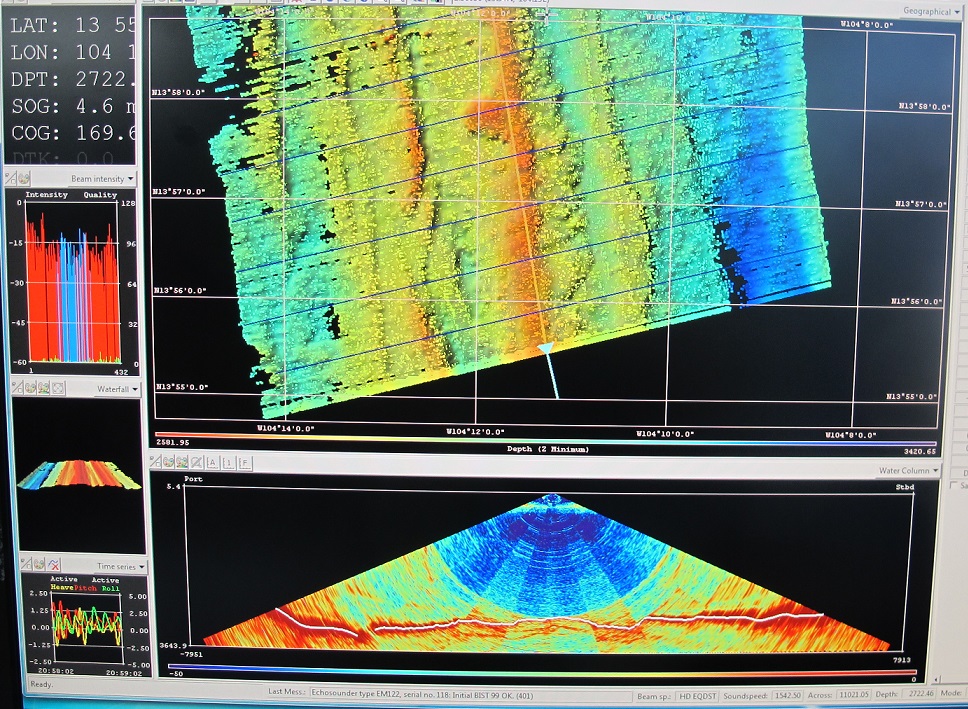
We’re following the ridge and mapping it using the ship’s multibeam sonar system. Its 432 beams of sound fan out to scan a swath of seafloor beneath us that’s more than 8 kilometers wide. The sound bounces back to the ship, creating a depth profile of the ridge. This particular stretch of the East Pacific Rise hasn’t been mapped in detail for more than a decade, so this is a perfect chance for us to do so with modern GPS and a much more sophisticated sonar system.
Scott White is keeping a close eye on the mapping to make sure the ship isn’t moving too quickly to collect good data. We’ve adjusted our course and speed slightly for the sonar survey. But because we were originally scheduled to arrive at our field site tomorrow afternoon, and Alvin always starts its dives in the morning, these tweaks let us squeeze in some bonus science without delaying our other work at all.
In other good news, the hurricane that was near our study site a few days ago has continued to move away to the northwest. If all goes well, Alvin should be able to make its first dive of the trip in just a few days!