Research ships like Revelle map seafloor volcanoes with sophisticated sonar-type equipment and can produce topography maps of the seafloor. In 2002 Havre volcano was mapped by the National Institute of Water and Atmospheric Research (NIWA) vessel, Tangaroa.
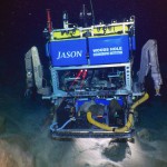
After the 2012 eruption the ship remapped the volcano, and by comparing these two maps we were able to determine the new (in 2012) eruption products. I’ve been staring at these maps for the past two years and now I get to use the AUV Sentry and ROV Jason to do some underwater geology.
-
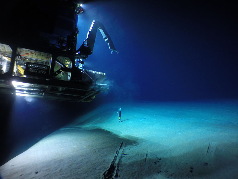
- S. Adam Soule, Woods Hole Oceanographic Institution, and Rebecca Carey, University of Tasmania; NSF/WHOI-MISO Facility, 2015; ©Woods Hole Oceanographic Institution
-
- S. Adam Soule, Woods Hole Oceanographic Institution, and Rebecca Carey, University of Tasmania; NSF/WHOI-MISO Facility, 2015; ©Woods Hole Oceanographic Institution
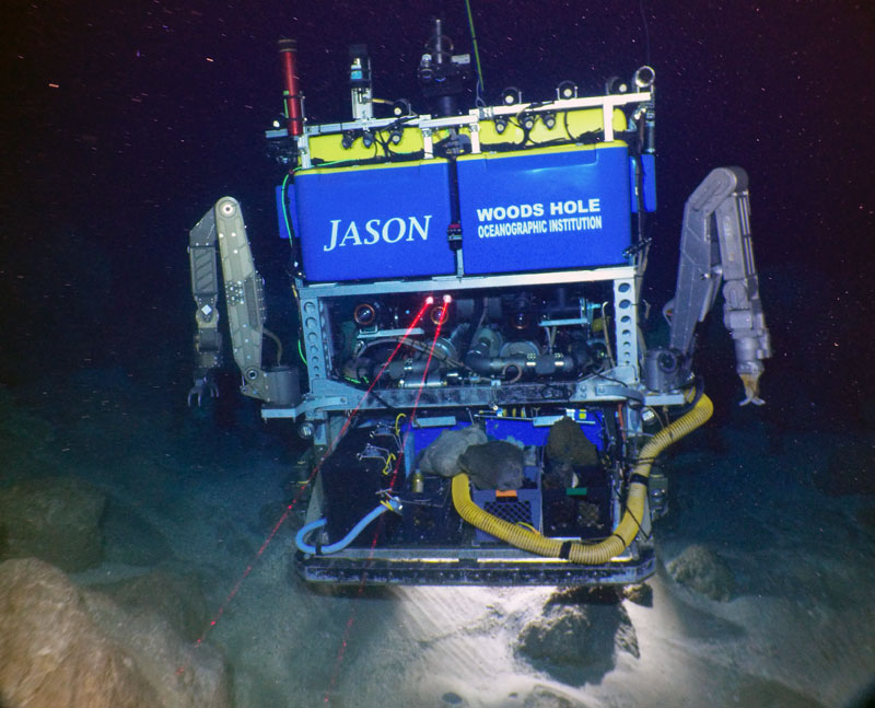
The combination of Sentry and Jason has been eye-opening. Sentry dives on particular parts of the volcano and provides us with maps of the seafloor pinpointing the features and locations to investigate with Jason.
Sentry has so far provided high-resolution images of the seafloor that show individual rocks and pumice clasts as small as one meter in diameter. Sentry has also detected the locations of hot, chemical-rich waters that are rising up through fractures in the volcano.
Not to be outdone, Jason is providing us with excellent close-up views of seafloor features with its seven cameras and collecting samples with its manipulator arms. These rocks will be analyzed later in the laboratory and the results will enable us to understand how submarine volcanoes erupt and transport eruption products through the water.
We’re saving lots of time with this approach and hope to be able to examine all of the 2012 eruption products. In just a few days of coordinated dive operations by Jason and Sentry, we have learned an amazing amount about this underwater volcanic environment. If there are more 2012 eruptive products out there to be found, Sentry and Jason will find them and we will be able to study them.