Although the research priority of our cruise is magnetic data, we are not passing up any opportunity to use the state of the art sonar-based instruments on the Sikuliaq to conduct surveys of the ocean floor under our path. Because these instruments rely on the sending, receiving, and timing of sound waves through sea water, we must be sure to be able to account for all the factors which can affect the speed of sound in the water between the ship and the topography below.
Thanks to marine technician Ethan Roth for a great briefing on the XBT
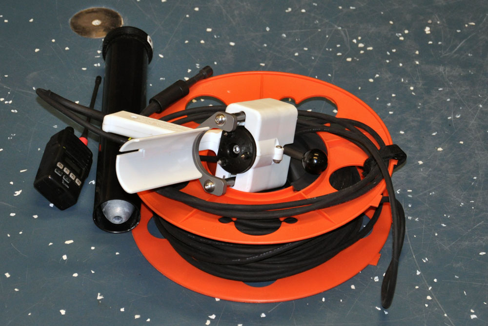
Enter the expendable bathythermograph (or XBT) : a disposable probe that profiles the temperature of the water column below the vessel
The speed of sound through seawater is a function of, in order of decreasingly powerful influence: pressure (and therefore depth), temperature, and salinity. Of these three factors, depth is easily the most predictable. The other two, however, can vary from place to place in ways that depth cannot. Making a bad assumption about the water conditions can lead to inaccurate ranging results, so it’s important to know these values. Since temperature has the larger effect, we start there.
It isn’t enough to take a single temperature reading of the water under the ship. Sonar signals have to travel through as much as 6000 meters of water to reach the bottom and that means we need an entire temperature profile — a curve plotting the temperature versus depth from the surface all the way down. The XBT is essentially a thermometer that is lowered down to about 750 meters and continually sends back a temperature reading up a length of copper wire.
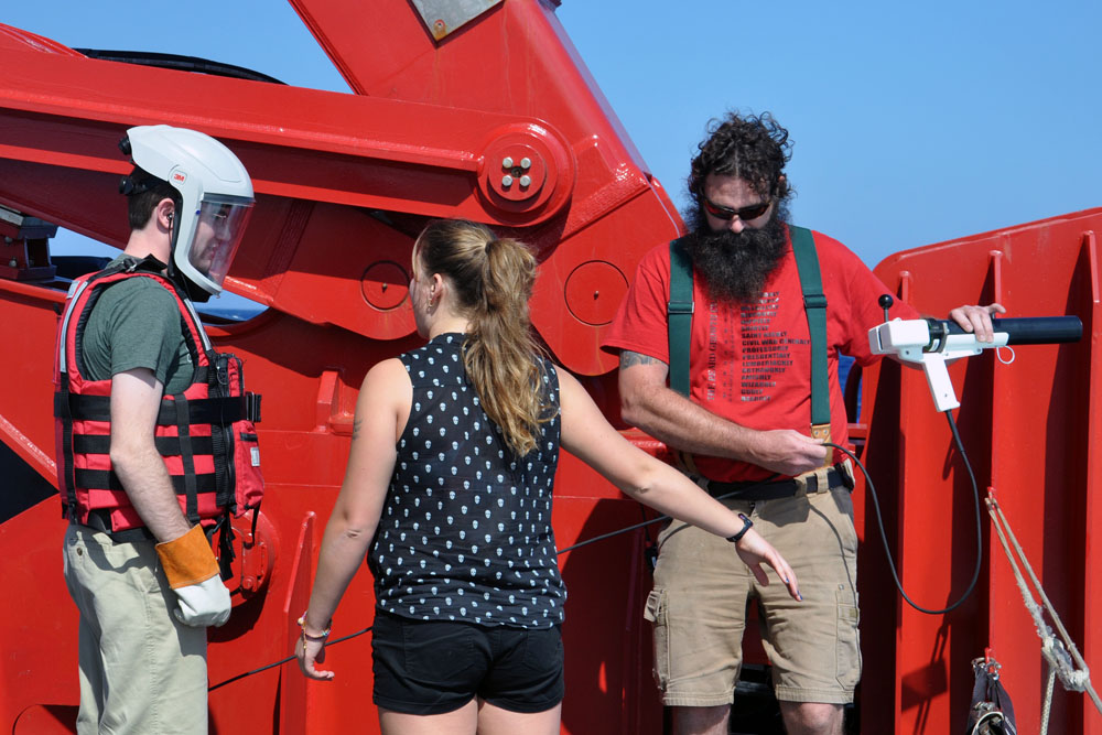
Preparing to guide new members of the science party through launching an XBT is a time honored, and much valued, tradition among the crew
While for our purposes there is a whole lot of ocean left below 750 meters, most of that deeper region stays relatively static in temperature. However, a lot can change closer to the surface. Depending on the location, temperatures near the surface may begin to fall off immediately, or they may remain steady for a few hundred meters in a so-called mixed layer of homogenized, similarly heated waters. At a certain point, we find a thermocline: the depth at which the water temperature begins to drop very rapidly. Finding the thermocline is vital to calibrating sonar to work correctly in the waters we’re surveying at any given moment.
Below 750 meters, we use data collected in the World Ocean Atlas, combined with our XBT readings, to extrapolate the temperature profile for the rest of the water column.
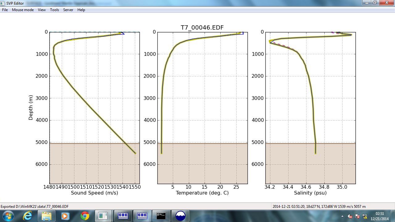
An example plot showing the speed of sound, temperature, and salinity versus depth. On the middle chart, the small vertical blue segment is shows the steady temperature of the mixed layer as seen by the XBT; the thermocline is the point where the temperature takes a dive to the left, the lower values.
Since we’re collecting sonar data while transiting at a decent speed, the convenience of the XBT is a big asset. The ship doesn’t need to slow down at all, and the instrument doesn’t need to be retrieved. Other cruises with different goals collect even more detailed water column profiles with a bigger instrument called a CTD, which must be deployed from a stationary vessel. We are trading off this precision for expedience, as the site of our magnetometric survey is still some days off.